
 Is there a better view in Sonoma Valley than 2,100 feet up sitting atop Gunsight Rock?
It’s the very first hike I did when I moved here five years ago, and I was woefully, naively and painfully unaware of what I was doing. That trip went up via Adobe Canyon Road on the way to Sugarloaf Ridge State Park. For my anniversary this week of my arrival on the Left Coast, I thought it would be fun to head up to the rock again. Instead though, I wanted to go up through Hood Mountain so I could try a few of the winding paths in the Hood Mountain Regional Park that are unfamiliar to me and to also stop at the mountain’s summit, which sits a few hundred feet higher than the appropriately-named Gunsight Rock.
It’s an unremarkable mountaintop summit, marked only by a wordy stone plaque and an inability to see anything thanks to trees, but, as I’ve often been told, it’s more about the journey. For our hike, we headed up a long, steep series of trails that start at the Pythian Road trailhead and zig-zag upward. There are a few ways to get to the summit, whether the summit or the mountain trail, and there are some meadows and creeks to be seen on the way. In any event, this is a hard hike. So is the other route from the Sugarloaf side – each one can easily be 7+ miles of tough stepping.
 We started fairly early in the morning and were the only people on the trail until we headed back down a few hours later. It’s a tough summer trek and only fit hikers will do it and not be winded. But once the early climbs are out of the way, panoramic views emerge of Santa Rosa and Sonoma Valley, and they are worth the panting.
Of course, the real payoff is at Gunsight Rock, a place for a breather, a meditative moment or just a brief nap and recovery.
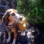 , New York native, I spent half of my life hibernating indoors, but for the past five years I have basked in the thrilling opportunity to enjoy year round hiking on the many trails of beautiful Northern California. In this blog I will continue in the tradition of trailhead, to recap the hikes I have taken and share the insights of my fellow hikers. Along with day hikes, I am also interested in dog friendly trails, and backpacking trips as well. Please feel free to offer suggestions of where I should hike next, or share tales of where you have explored. . Guest blog entries are extremely welcome as are your photos from your own hikes.