With rain dampening everything last week, it looked like the chance to do much hiking this past weekend would be a washout. But I was hopeful that I would get a chance to use some of my hardly-used rain gear out in the woods somewhere. So I was really heartened when the person organizing the hike I had planned on going sent out a “rain or shine, hell or high water” type of note vowing to trek through the elements no matter what. My kind of hiker, definitely.
Other than occasional drizzles, this weekend was actually pretty good for hiking, depending on where you were in the Bay Area. On Saturday, I was at a nature reserve run by US-Davis. It’s on the eastern side of Lake Berryessa in Napa County and is officially called the Stebbins Cold Canyon Reserve in the Putah Creek Wildlife Area. There are no facilities at the trailhead other than a kiosk with a map, and the parking area is a large dirt space that’s easy to overlook. It’s right on Highway 128 about 10 minutes west of Winters.
Hiking at Stebbins is not the longest trek, a complete loop runs about five miles, but it’s a rigidly arduous five miles with steady switchbacks, a steep incline and rugged footing going up and coming down. And that’s on a clear day. Last time I hiked there was in the summer and because I was in a hurry, I treated it as a cardio challenge, nearly running the entire time and getting a workout.
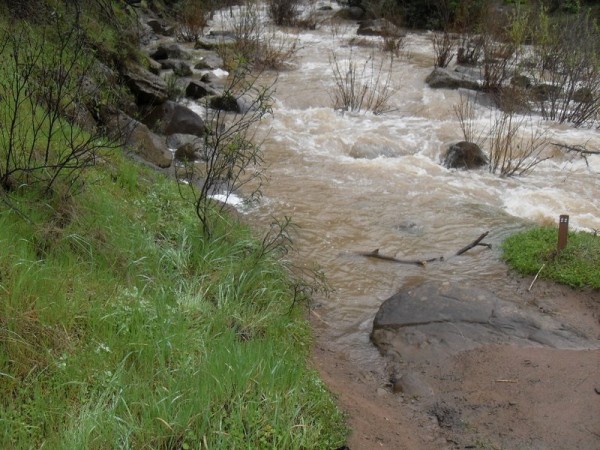
The water from the last week made this a slower and more technical hike. For one, we couldn’t do a complete loop. After hiking in about a quarter of a mile, the trail met a river. Literally. In the picture above, at the bottom is the trail which would normally continue across dry land and go straight. Instead, we were faced with a raging river that was impassable. One of our group tried valiantly, and in the pictures below (they’re 9-13 in the slideshow), you can see the sequence of shots as he risked his life to get across. He didn’t make it across, but he also didn’t drown, so that’s something.
We also faced some mud and rock slides blocking the trail and other flood-impacted debris throughout, in addition to extremely slick muddy footing going up to the peak. But at the peak, which is about 1,500 feet high, there is usually a terrific view of Lake Berryessa, and we got to savor that over lunch. The lake used to be a hot spot for boaters and vacationers, but it’s sort of in transition now, meaning there’s not much activity
out there. But it is surrounded by breathtaking ridgelines in nearly every direction. You could hike in that area again and again (and much of the Stebbins’ trails are dog-friendly, for what it’s worth), and pick different routes each time for varying vistas.
[nggallery id=45]


 , New York native, I spent half of my life hibernating indoors, but for the past five years I have basked in the thrilling opportunity to enjoy year round hiking on the many trails of beautiful Northern California. In this blog I will continue in the tradition of trailhead, to recap the hikes I have taken and share the insights of my fellow hikers. Along with day hikes, I am also interested in dog friendly trails, and backpacking trips as well. Please feel free to offer suggestions of where I should hike next, or share tales of where you have explored. . Guest blog entries are extremely welcome as are your photos from your own hikes.