A few months ago, I was on a hike somewhere and saw a note on a kiosk board talking about the Bay Area Ridge Trail. It’s a 325-mile stretch of trails that forms a huge vertical loop around the Bay Area.
It has coastal and mountain sections, bike and horse trails and touches nearly every part of the area. And it is a work in progress, being slowly pieced together over the past 21 years. Last month, I hiked on the newest section, the North Slope of Sonoma Mountain, which is not yet open to the public but soon will be as part of a Sonoma County regional park.
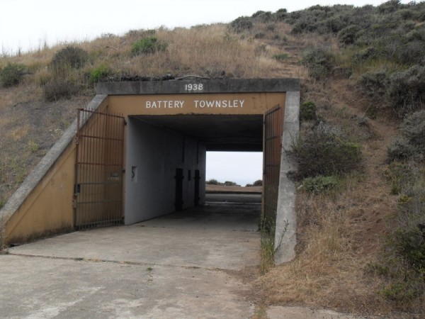
On Saturday, I hiked in the Marin Headlands, doing about 10 miles of the Ridge Trail, with a large group of people who have been completing different sections of the trail periodically, alternating between North Bay and South Bay segments. This hike started at Fort Cronkhite, a former World War II military post that has been preserved as a museum. Visitors can see the barracks, mess hall, supply stations and other fort buildings, all of which are located right by Rodeo Beach. Thousands of Army soldiers spent their tours of duty stationed here at the coast, waiting for the enemy to hit American shores. It didn’t happen, but these so-called mobilization posts were a big part of the U.S. defense strategy at the time. Not far inland and uphill from the trailhead are plenty of bits of old buildings and tunnels to explore. If you are a military buff, you’ll definitely want to check out the Battery Townsley facility, which once housed two huge guns capable of firing 25 miles out to sea.
I had never heard of the fort or any of the nature-related organizations housed there, but there was a lot going on, and it’s worth a return visit to this part of the Golden Gate National Recreation Area. Just take the Sausalito exit and go west. Many people were out at the beach, watching the surfers or huddling on the sand from the wind. It was a fairly mild day by surfing standards but as one surfer said in the parking lot, “I’m here so I’m surfing, no matter what.”
Our group headed on a large counter-clockwise loop, reaching about 1,100 feet in elevation. From the top, we had a good view of Sausalito and some of the Bay islands, although heavy fog and wind made extended sightseeing difficult. Still, it’s an incredible way to view San Francisco and the coast. I can see why the trail is so popular with bikers – wide paths, gently sloping uphillls and some good straight-away downhills. The Marin Headlands are literally criss-crossed with trails, so it was good that we had a leader with a plan and a map, and that it was possible to see water from most directions so getting lost wasn’t likely. It’s possible to start at the Golden Gate Bridge itself and hop on the Ridge Trail from there and head north. For more on the B.A.R.T., click here.
[nggallery id=20]


 , New York native, I spent half of my life hibernating indoors, but for the past five years I have basked in the thrilling opportunity to enjoy year round hiking on the many trails of beautiful Northern California. In this blog I will continue in the tradition of trailhead, to recap the hikes I have taken and share the insights of my fellow hikers. Along with day hikes, I am also interested in dog friendly trails, and backpacking trips as well. Please feel free to offer suggestions of where I should hike next, or share tales of where you have explored. . Guest blog entries are extremely welcome as are your photos from your own hikes.